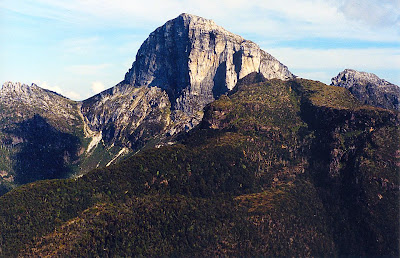
OK, I'll grant you, this is a bit trivial, and may not get the same level of support as other more worthy causes. However, I've climbed it, and got dehydrated as a result, so I want it properly recognised. Sharlands Peak is 1140m tall. If the ground falls away on all sides to below 990m approximately, then it's an Abel. It didn't make the original list, which I only discovered after I'd returned from climbing it.
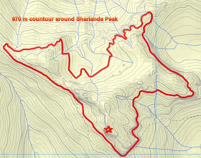
What I think happened is that when the original Abels list was drawn up, the Vera 1:25,000 map wasn't yet available. The contours on the 1:100,000 map are very much less detailed, and on that map it does indeed look like Sharlands Peak is joined to Frenchmans Cap above the 990m level, or at least it's very ambiguous. The 1:25,000 Vera map makes it look like Sharlands Peak should be an Abel. To confirm this, I've used the "Info" feature of The List to find the 970m contour, which I can draw all around Sharlands Peak.
I think this demonstrates that Sharlands is an Abel. Sharlands is connected to neither Frenchmans Cap nor Philps Peak within a vertical 150m of its summit. QED. Happy to be shown to be wrong, but I reckon I'm right!


No comments:
Post a Comment